The quick answer · Follow the source of the air
A gust front comes from a thunderstorm; a cold front separates air masses
The NWS defines a gust front as the leading edge of gusty surface winds produced by thunderstorm downdrafts. An outflow boundary separates that rain-cooled air from the surrounding air. A synoptic cold front is a much larger transition where colder air advances and replaces warmer air.
- Do not judge by the cloud alone. A shelf cloud often marks thunderstorm outflow, but the official radar, forecast, and alert supply the decision context.
- Expect the wind first. Outflow can move ahead of the rain and lightning that produced it.
- Use the loop. A moving fine line can reveal a boundary better than one radar image.
- Read the warning. A warning is the action message; the boundary label is an explanation.
Scale and cause · Similar passage, different feature
Why a gust front can feel like a small cold front
Rain-cooled air descends in a thunderstorm downdraft, reaches the ground, and spreads outward. Along its leading edge, a gust front can produce a sudden wind shift and a temperature drop. That is why the NWS describes an outflow boundary as similar in effect to a cold front.
The origin and scale are the difference. A cold front belongs to a broader weather system and marks the advance of one air mass into another. A gust front is tied to thunderstorm outflow and may race away from the rain that created it. The NWS notes that outflow boundaries can persist after their parent storms weaken and can help trigger new thunderstorms where air converges.
Shelf cloud · A clue, not a severity meter
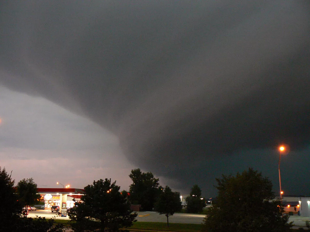
A low arc of cloud can mark the leading edge of outflow
NOAA explains that rain-cooled air spreading from a squall line can force warmer air upward along the leading edge. The rising air cools and condenses into the low, horizontal arc commonly called a shelf cloud.
The shape can be dramatic, but appearance alone does not tell you the wind speed at your location or replace a warning. A shelf cloud usually marks thunderstorm outflow; a wall cloud has a different relationship to storm inflow and rotation. Use the current warning text, radar loop, and safe observation rather than trying to grade danger from a photograph.
Radar · Look for motion and context
An outflow boundary may appear as a thin arc away from heavy rain
Radar can sometimes detect insects, dust, moisture differences, or other small targets concentrated along a moving boundary. The result may be a fine line or arc that travels outward from the storms. Some boundaries are obvious; many are not.
Loop the image and compare it with the location of storms, wind observations, and the NWS forecast. In an official Nebraska case review, an outflow boundary acted like a small-scale cold front and helped initiate new thunderstorms. A case study explains a process; it does not forecast the boundary over you today.
Four products · Four different jobs
Outlook, forecast, watch, and warning describe different decisions
- Outlook
- A broader, earlier assessment of where organized severe storms may develop. It is not a prediction that a gust front will cross your address.
- Forecast
- The expected weather for a defined place and time. Use the local hourly forecast to plan around wind, rain, and thunderstorm timing.
- Watch
- The risk of a hazardous event has increased, but its exact occurrence, location, or timing remains uncertain. Be ready to act.
- Warning
- A hazardous event is occurring, imminent, or likely in the warned area. Follow the warning’s protective-action instructions immediately.
A boundary can exist without a warning, and a severe warning can remain urgent even if the heaviest rain is somewhere else. The NWS safety guidance says to move inside a sturdy building and to an interior room or basement during a severe thunderstorm or high wind warning.
A practical boundary check
Use a five-part check before travel or outdoor activity
- Check active alerts first. Read the hazard, warning area, valid time, and official action statement.
- Read the hourly forecast. Match expected thunderstorm and wind timing to departure, activity, and return times.
- Loop the radar. Watch the boundary and storms move; verify the timestamp and do not rely on one frame.
- Notice safe clues. A fast wind shift, falling temperature, blowing dust, or an approaching shelf cloud can mean outflow is arriving.
- Move inside when directed—or when thunder is heard. Do not wait for rain to reach you, and stay away from windows during damaging wind.
Why MyUSA.us publishes this
Official public weather data should be clear and easy to use
Americans already fund official radar, forecasts, outlooks, watches, warnings, and safety guidance. MyUSA.us helps connect those public tools without subscriptions, advertising clutter, or unnecessary tracking.
Official weather. No ads. No clutter.MyUSA.us is an independent weather website and is not affiliated with NOAA or the National Weather Service. Always follow current official warnings and instructions from public authorities.
Page reviewed: October 24, 2026